Ouachita River Crossings
I30 Crossing at Malvern
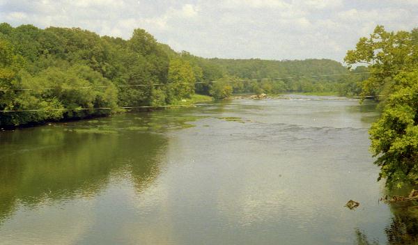
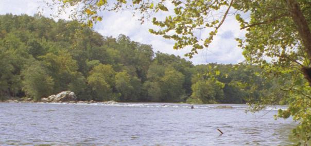
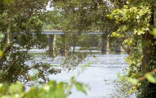
 After Interstate Highway 30 opened between Little Rock and Texarkana, we began driving that way in our annual pilgrimage back home. I was struck by the beauty of this section of the Ouachita River near Malvern with its beautiful rapids and small rocky island. I even stopped on the bridge and took a picture back when traffic was not as heavy as it is today. This photo was taken in August of 2003. I parked on the highway shoulder (which is against the rules, I think) and walked about 50 yards to the bridge. Big 'semi' trucks were whizzing by just 8 to 10 feet away and the bridge flexed every time one passed. By the time I returned to my car, a highway patrolman had stopped someone about a quarter-mile back up the road, so I hurriedly went on my way. This dedicatory plaque is imbedded in the concrete of the bridge.
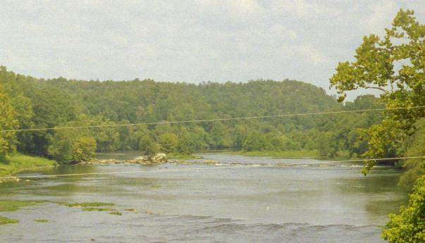
This 'digital telephoto' view scanned from the previous image shows the islands and rapids in greater detail. Dams on the Ouachita further upstream near Hot Springs probably keep a fairly constant flow and river level.
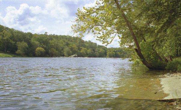
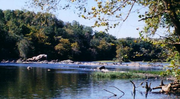
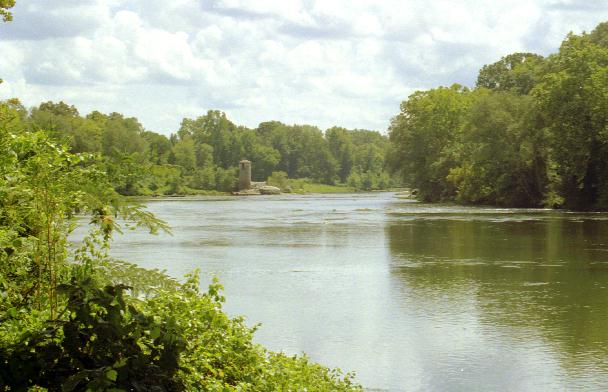
On a return trip to Arkansas, I stopped in Malvern to get more views of the Ouachita. Thanks to Jimmy of Rusty's Feed and Seed, I went to what he called a 'water park' for a better view of the river upstream of the I30 bridge. A nice concrete boar ramp leads down into the river and a concrete walk follows the river bank for some distance. The area around the top of the boat ramp has been scrapped and leveled and looks like a rock quarry.
This is a 'digital telephoto' view of the islands and rapids from the boat ramp. Look up the way the stick in the water is pointing. The dark object with gray helmet top in the rapids is a person riding a kayak type device. There were two people there and I thought they would be coming on down the river. Instead they just moved back and forth in the rapids and appeared and disappeared in the water.
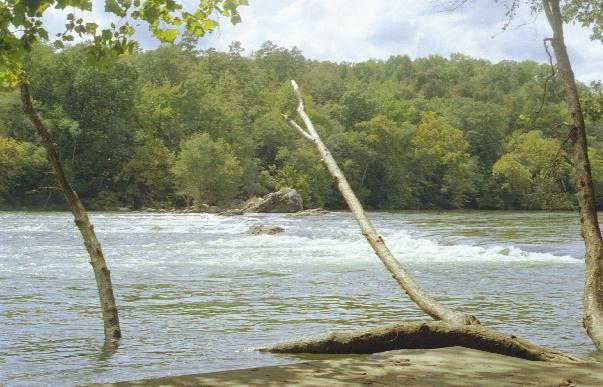
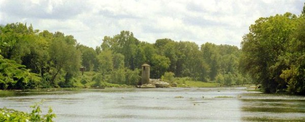
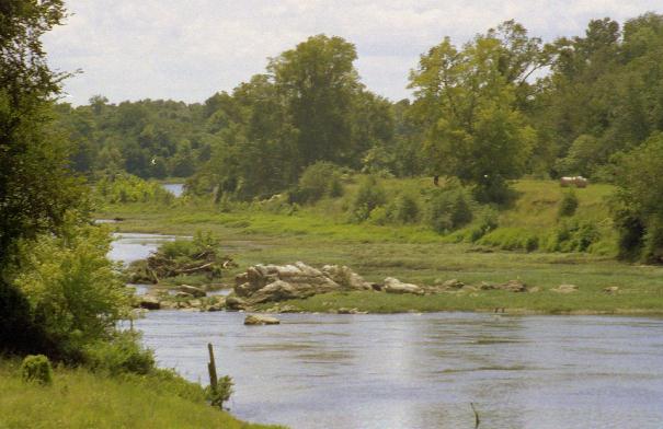
I returned in the fall and found that the river level had dropped significantly. The rocky ridge that creates the rapids is revealed in this photo from approximately the same location.
Dogs were barking up the river bank and, as I walked that way, they barked even more. The couple, who had been playing in the river, hurried to shore to keep the dogs from attacking me! I didn't want to disturb them, but they were concerned about the dogs even though the dogs were tied to a park bench and tangled in some small trees. The young fellow got out of his flotation device and calmed the dogs while I took this photo. He and I then talked while his wife went back into the river to play. He told me that the half surfboard-half kayak devices were like wings and with them they could 'fly' through the water and do 'aquabatics.' He said that the river was about 12 feet deep in that area and the current and eddies below the rapids (or underwater falls) would take them to the bottom where they could feel the moss growing on the rocks. By controlling the angle of the devices they could 'plane' back to the surface and do other acrobatic tricks.
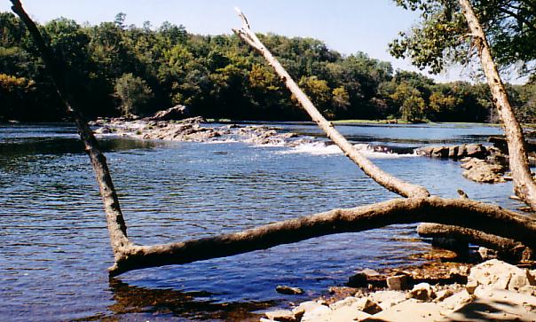
This photo was also taken in the fall when the river level was low.
There is an old washed-out bridge downstream of the I30 bridge. The downstream area is more difficult to see from I30 because the river begins to swing back to the southeast. This view of the I30 bridge is from the approach to the washed-out bridge.
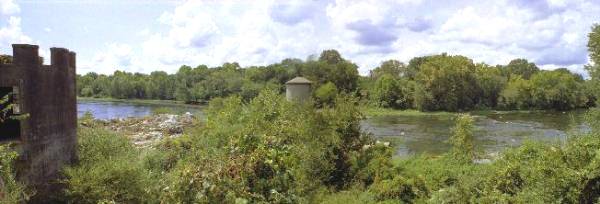
The road to the 'water park' goes under the I30 bridge and I stopped there to take these views downstream toward the old bridge area.
This is a 'digitally stitched' telephoto panoramic view downstream. The approach to the old bridge is behind the trees about one quarter of the way from the left side of the photo.
Two views of the river from the old bridge approach are roughly stitched together to make this panoramic view. A marble marker indicated that some efforts had been undertaken to replace the old bridge. I don't know how the towers related to the bridge.
There were several large rock outcroppings on this side of the river. A two-story, red brick colonial style house was on the property next to the old bridge approach. The back yard of the house stretched down to the river bank. One of these days we may stop and ask if we can get better access to the river by crossing their property.

Posted: 7/20/03
 Sign My Guestbook