The Great Sand Hill

in

The Boquillas Canyon

of the

Rio Grande River

in

Big Bend National Park

West Texas


The Rio Grande River exits the Big Bend National Park through Boquillas Canyon, an impressive canyon with sheer, vertical rock walls cut through the Sierra Del Carmen. A parking lot is within a mile of the canyon entrance and it is any easy hike for all the family. Just inside the entrance to canyon against the cliff on the north side of the Rio Grande River is an immense pile of sand. The sand appears to have poured from a hole in the cliff about 100 feet up but it actually was blown in by the wind from the surrounding desert.

Beside the view of the canyon cliffs, the river, and the little town of Boquillas, Mexico, (visible from a high point on the trail) the main entertainment feature is the sand hill. It is a challenge to climb and visitors use various techniques for descending. Some try sliding on cardboard boxes and some just run and fall. I was able to run down the full length of the hill and the exciting thing was that my steps were at least 10 feet in length, perhaps longer. I would just leap off from one foot and sail through the air down the face of the sand hill and land on the other foot. Each time my foot hit the sand I would slide several feet. It took great balance to avoid a fall. It has been many years since I did it, but I think it took more than ten steps to reach the bottom. My estimate of the height of the hill is based on my run down the hill.

FILM NOTE: When making photographs of things you may not have an opportunity to photograph again, it is better to use film and equipment you are familiar with. I made the mistake of using film that I had never tried before for these photographs. The film was 5254 color negative 35mm movie film that had been re-spooled in 35mm still camera film canisters by a photo supply and processing company on the west coast. The company promoted it as a universal film that could be used for both prints and slides. It was easy to make slides from the film because of the availability of a matching 35mm color positive movie film. I found that the film was very contrasty and lacked exposure latitude. The prints and slides both were washed out and bluish. The negatives were scratched pretty badly during processing and I think some were missing. These images were scanned from the original negatives and my photo software corrected some of the color and contrast problems. Although these photos are not of the best quality, I hope they will pique your interest in the rugged Big Bend area.

The final image was scanned from a 4x5 Cibachrome print that I made from a Kodak Ektachrome slide. I don't think Kodak makes Ektachrome in 35mm format anymore.

One Two
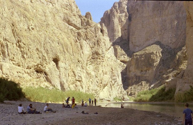
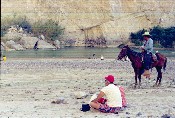
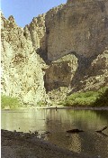
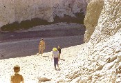
This scene is just inside the entrance to the canyon. The trail opens onto a rocky beach on the north side of the river. The sheer cliff is the Mexican side of the river at this point. I believe the man on the horse is a Mexican national. Back then, there was no restriction on border crossing at various locations in Big Bend National Park. 
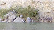
Plants cling to a precarious perch between the river and the sheer cliff wall.
One A Two A
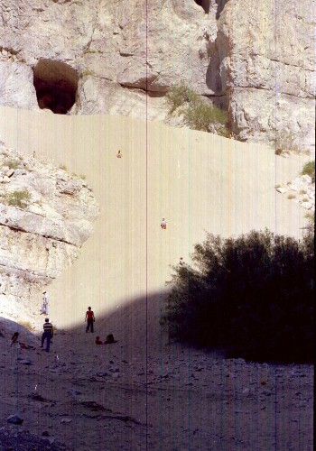
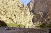
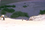
As the river continues it swings closer to the north wall leaving a sandbar on the south. The canyon is in shade until late in the morning. It can be pretty cold until the sun is in position to shine on the sand hill. On warm, sunny days, the sand becomes almost too hot for climbing with bare hands. 
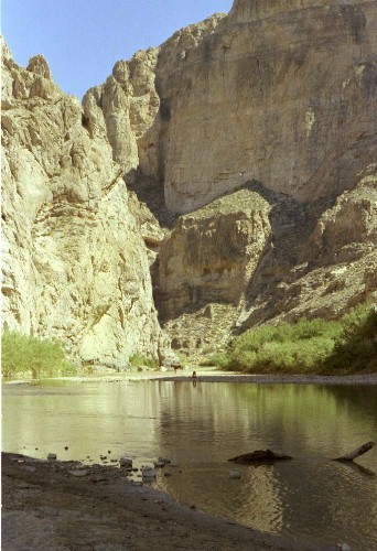
The beach runs out and the river continues between the vertical walls of the canyon. I think I see a horse on the sandbar on the Mexican side in the distance. A river rafting information site says the canyon continues for 33 miles and the Sierra del Carman reaches heights of 7000 feet above river level.
Three Four
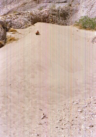
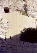
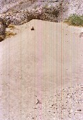
It is difficult to show the steepness of the sand hill. Compare the relative sizes of the images of the people at the foot of the hill with those at the top. 
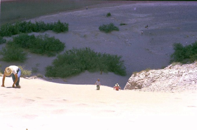
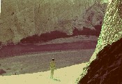
This view of the RioGrande from the gravel shelf in front of the cave give a better indication of the height of the hill. Compare the people at this level with the little dots of people down at the riverbank.
Five Six
This view of the climb at about halfway up the hill gives a better indication of the height. 
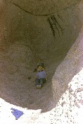
This looks like Louis. He may have climbed the rocky area beside the sand rather than up the sand face. There is a ridge of sand at the top of the hill and the sand slopes down a little to the rocky area in front of the cave.
Seven Eight
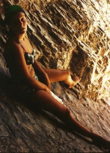
I climbed onto a knob on the back wall and posed for this picture taken by Ann. Just after I climbed onto the knob to rest, a young woman in a bikini swimsuit entered the cave and sat down. Apparently she had not noticed me until I took the photo of her that appears at the end of this page. 
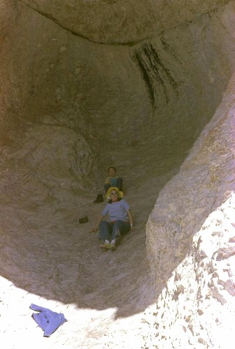
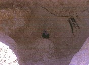
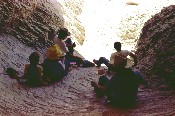
The cave is a bowl-shaped depression in the side of the cliff. This view shows Ann and Louis in the cave.
Nine Ten
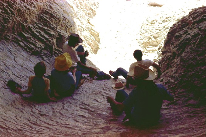
View of a group resting at the mouth of the cave from my vantage point on the knob inside the cave. Louis, Ann and others. Ann is in the yellow hat and Louis is behind her. This photo, although of poorer quality, gives a better impression of the height of the sand hill. The image size of the young woman in the bikini swim suit can be compared to the image size of the people on the river bank. The canyon entrance is just to the right side of the picture.
Eleven
This is the photograph of the young woman in the bikini who had also come into the cave to rest in the shade. She either didn't know I was there or didn't realize that I was photographing her until just before I snapped the shutter. The golden color is greatly exaggerated, but produces a nice effect.

Line
SCENES FROM BIG BEND Photos of the Chisos Mountains, the 'window' of the Chisos Basin, sunset through the window, Santa Elena Canyon view, a scene from Palo Dura Canyon in northwest Texas, and a windmill on the high Texas plains.
LARGE MAP of BIG BEND This large map may be of interest to you. It is over 800k in file size.
Line

Skipper Family Magazine
SITE INDEX

Re-posted: 12/26/02