Coin Harvey's Resort at Monte Ne - Page 2
Bank Block
The shell of the old "Bank Block" as it looked in 1961 before Beaver Lake was filled.


1910 Monte Ne
Monte Ne - 1910
Photo Source - Although these two old image are probably now in the public domain, I'll give credit to this source. I added the annotations identifying the buildings. The view is to the west from what is now the east side of the lake. The old town site and the Bank Block are under the waters of Beaver Lake. The Bank Block was demolished before the lake filled. Oklahoma Row was built on the ridge west of town and its foundation is above lake level. The log building was moved from the foundation to a new location beside the highway into the area. The three-story 'tower' at the south end of the foundation is still standing in 2005. My guess is that the light colored area in the trees in this old photo is the top of the tower. The lagoon was on the west side of Oklahoma Row and it went south to the amphitheatre.
Oklahoma Row Postcard
Oklahoma Row
Compare this close view of Oklahoma Row with the view in the photo of Monte Ne above.

I was very impressed by this concrete building which seemed to have been cast in one piece. These were the first old ruins I had ever seen. Several fireplaces with chimneys were cast into the walls and the heat from them must have been nice during those cold north Arkansas winters. The large windows would have provided light as well as ventilation during the hot summer season. The date over the entrance is 1905 and "Bank Block" is molded into the top of the wall.

I think that the lens in my Kodak Signet 40 had some 'pincushion' distortion and that, with the short focal length, may have caused the distortion in the verticals of the lower photo.


Bank Entrance Fireplace
The Front Entrance A Cast-in-place Fireplace


Bank Facade
The Bank facade from lower left to upper right.

Lagoon Lagoon
The View of the Lagoon looking north from amphitheatre podium. The View of the Lagoon looking south toward the amphitheatre.


Bridge Sign Post Jane
A Bridge A Sign Jane Roberts

The area along the lagoon near the amphitheater was maintained like a park and people came for picnics and to explore the area. It was a nice place to bring dates. The color image was made on Ektachrome film. I think that either I or my uncle processed the roll in his darkroom. It is one of the few slides that have faded to amber. Photo software bought a lot of the color back. The bridge crossed a small channel that either feed or dranined the lagoon. I didn't trace the water system. The arrow directional sign was made of heavy iron plate. It was about two feet long. The upper view was taken from the wood plank leading to the podium and the lower view looks back toward the podium. The amphitheater entrance is visible.

PAGE 1 - The story of Coin Harvey and Monte Ne with photos of the amphitheater.
PAGE 2 - Concrete Bank Block Building and Views of the Lagoon
PAGE 3 - Lodge, Burial Vault, and Photos with the Lake at Three Levels
PAGE 4 - 1977 Lake Level marked on Old Photos, Views into the Water, Checking the Time Capsule, Related Links
PAGE 5 - Lissa Myer's Current photos of the ruins at Monte Ne: the Tower Windows, old foundations, and crowds at the amphitheater.
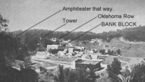
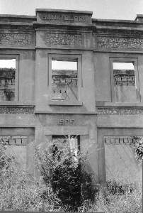
PAGE 6 - 2005 Views of Oklahoma Row foundation and tower with a new summary of the events of William Hope "Coin" Harvey's involvement with his Monte Ne Resort and the good roads movement. This page includes many links to other informative web sites related to Coin Harvey and Monte Ne.
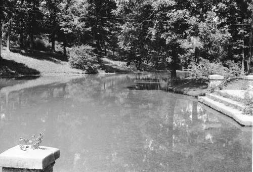
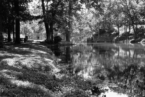
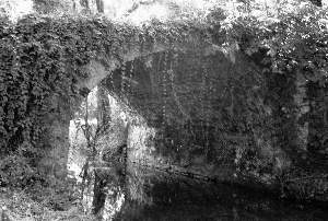
PAGE 7 - Photo and map of the old townsite with a panoramic photo of some of the foundation ruins on the lake shore and across the lake to the amphitheater. There is a photo that shows the new location of Harvey's tomb. The text includes some comments from a U.S. Corps of Engineers employee who toured the Monte Ne site for the Corps in the early 60s.
PAGE 8 - Coin Harvey's Amphitheater around the Big Spring at Monte Ne. Harvey planned this to be the foyer for his pyramid or obelisk in which he planned to place a"time capsule" or museum room to hold all the important documents and marvels of civilization. However, that was never to be because he was unable to obtain financing. The photos on this page show the upper parts of the amphitheater now exposed by the dropping waters of Beaver Lake. Old photos from before the lake was built and at other times when the lake was low are included for comparison.
PAGE 9 - This page continues the amphitheater description with the south wall. Most of the south wall is under water even with the lake level at 1106 feet above sea level. The south wall may have been the planned entrance to the pyramid and time capsule that Coin Harvey wanted to build. In any case, he probably planned to build the pyramid, or obelisk, on the little hill behind the amphitheater. That little hill is an island when the lake level gets to the 1120 to 1125 range as shown in the photo posted on the previous page.
PAGE 10 - On the side of the hill behind the south wall is a tall retaining wall. The area was so covered in brush in 1961 and I was so hesitant about the possibility of trespassing that I didn't find that wall. There is a paved driveway leading from the east of the amphitheater up to the area above the wall where the railroad depot used to be. There are also panoramice photos of the view from the amphitheater back toward the old Monte Ne town site.
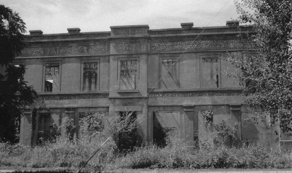
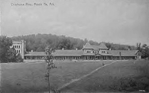
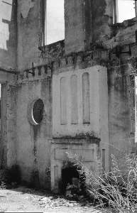
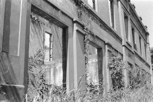
PAGE 11 - Selected Monte Ne Resort photos from the Rogers Historical Museum used by permission. Photo of old Monte Ne in great detail. Photos of the Bank Block when new and years later after it had been gutted by fire or weather. Photos of the amphitheater from its unfinished construction in 1928 and when that part of Beaver Lake was dry in the winter of 1977.
PAGE 12 - 2006 Wedding in the Monte Ne amphitheater. First wedding there in more than 40 years? Photo of Ann in the amphitheater in 2006 compared to a similar photo from 1977.


Skipper Family Magazine
SITE INDEX PAGE
To purchase a CD of these and more old Monte Ne photos (about 50 total from 1961 to 1977) plus some recent (2005-2006) photos and a tourists' leaflet giving a brief history of the Monte Ne Resort illustrated with photos old and new and including a map showing the old Monte Ne area above and below the lake,

Send $12.50 through Rock Island Press
Or e-mail me at:
jamesmskipper@netzero.com
for other arrangements.
Historic Monte Ne CoverFor a definitive picture album/history of the resort at Monte Ne, purchase Allyn Lord's Historic Monte Ne published by Arcadia Publishing in its Images of America series.


Original Post Date - 2001
Updated - 11/20/05